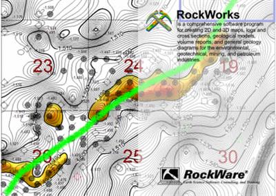
RockWare RockWorks 2022.7.28 | 353.7 mb
Product:RockWare RockWorks
Version:2022.7.28
Supported Architectures:x64
Website Home Page :www.rockware.com
Languages Supported:english
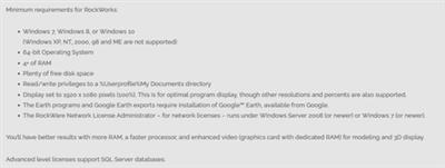
System Requirements:Windows *
Size:353.7 mb
The software developer RockWare is pleased to announce the availability of RockWorks 2022.7.28 is a 3D modeling software product that helps you create detailed 2D and 3D geotechnical maps.
(013) 07/22/22/MIW -Bug Fix:
The Graphics >Animate >RockDescription 3D File now correctly generates a video when using the Advanced option.
(012) 07/20/22/MIW -Improvement:
The IsoSurface display options now includes an option to display the cap and cutaways as contoured or solid.
(011) 07/18/22/JPR -Removal:
The gINT import option has been removed.
(010) 07/13/22/MIW -New Feature:
3D Faults can now be exported directly to DXF and Shape File formats.
(009) 07/12/22/JPR - Bug Fix:The ModOps / Solid / Math / Solid Math / Constant divided by Solid option now works correctly. The previous version would fail to create a model.
(008) 07/11/22/MIW -New Feature:
2D Faults can now be exported to DXF and Shape File formats.
(007) 07/10/22/JPR -New Feature:
A new program titled "Migration Simulation" has been added to the Graphics / Animate menu. This program will create animations in which the low values migrate to the high values or vice-versa.
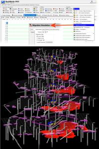
(006) 07/10/22/JPR -New Feature:
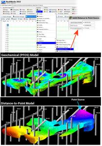
A new program titled "Distance to Point" has been added to the ModOps / Solid / Filters menu. This program will replace non-null nodes with values equal the straight-line distances between the nodes and a specified point source.
(005) 07/08/22/JPR -Improvement:
The "Use Faults" option within the solid model smoothing dialog is now disabled by default and the option title has been changed to "Use Faults (Very Slow)".
(004) 07/08/22/MIW -Improvement:
The coordinate minimum and maximum values have been added to the RockDescription3D file in order to make Embellishing the file clearer. Files will need to be resaved before the extents will be added.
(003) 07/05/22/JPR -Cosmetic:
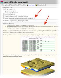
The "Strat Rules" tab now includes a blue help button adjacent to the 'Include Additional Contacts' option which will display detailed information about adding supplemental points to the stratigraphic modeling.
(002) 07/03/22/JPR -Bug Fix:
The Utilities / 3-D / Triangle Mesh program no longer asks for a title column or line thickness and no longer Descriptions duplicate sets of triangles.
(001) 07/03/22/JPR -Removal:
The Isosurface option has been removed from the Stratigraphy / Solid Model program.
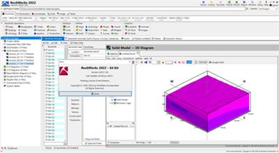
RockWorksis the standard in the environmental, geotechnical, petroleum, and mining industries for surface and subsurface data visualization, with popular tools such as maps, logs, cross sections, fence diagrams, solid models and volume calculations.
RockWorks offers numerous options for analyzing your surface and subsurface data, and accepts many different data types, such as stratigraphy, lithology, downhole geochemistry / geophysics / geotechnical measurements, color intervals, fractures, and aquifer data.
Tunneling With RockWorks
RockWare was foundedin 1983 by geologists to create and market affordable geo-scientific computer applications. These products include RockWorks, RockWare GIS Link, and LogDescription which are developed and supported in-house. RockWare's products are used in virtually all countries of the world and are considered the standard in subsurface visualization.
Download From UploadCloud
https://www.uploadcloud.pro/c2u29am4p8am/jj0qw.rar.html

https://uploadgig.com/file/download/713CC955ABc4647b/jj0qw.rar
 -->Click Link PeepLink Below Here Contains Rapidgator
http://peeplink.in/fb6582d7a71d

https://nitroflare.com/view/50940B24F0B947A/jj0qw.rar
https://www.uploadcloud.pro/c2u29am4p8am/jj0qw.rar.html

https://uploadgig.com/file/download/713CC955ABc4647b/jj0qw.rar
 -->Click Link PeepLink Below Here Contains Rapidgator
 http://peeplink.in/fb6582d7a71d

https://nitroflare.com/view/50940B24F0B947A/jj0qw.rar
Links are Interchangeable - No Password - Single Extraction
