Free Download Aquaveo Groundwater Modeling System (GMS) 10.8.8 | 946.0 mb
Aquaveo, a water resources consulting company, is pleased to announce availabilityGroundwater Modeling System (GMS) 10.8.8is the most advanced software system available for performing groundwater simulations in a three-dimensional environment
Owner:Aquaveo
Product Name:Groundwater Modeling System (GMS)
Version:10.8.8 Premium
Supported Architectures:x64
Website Home Page :www.aquaveo.com
Languages Supported:english
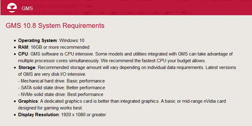
System Requirements:Windows *
Size:946.0 mb.
What's New in GMS 10.8.8 - Date: December 17, 2024
Projection
- 15334 Projection for *.asc Raster Filesnot handled correctly-
- 15395 Projection Labels Are Reading Incorrectly
MODFLOW-USG
- 15344 Horizontal Anisotropy Is Not Being Applied in MODFLOW USG
MT3DMS
- 15385 Display of UGrid not correct after running MT3DMS
Undefined
- 15278 Update version of MT3D-USGS
- 15373 "Reproject Rasters" Tool Converts Units Incorrectly
MODFLOW
- 15398 Aquifer and Species Properties in MDT Package Freeze GMS
- 15346 GMS Crashes When Trying to Paste Data into TVM Package
- 15417 PEST fails when there is only one parameter using pilot points and it is a RCH parameter
MODFLOW6
- 15370 Simulation Run Queue says MODFLOW 6 Run with SAMG+ passes but it doesn't
- 15376 MODFLOW 6 Disu Grids Receive an Incorrect HWVA Array
Cleanup
- 15404 Clean tool - delete short arcs deletes arcs that it should not
Online Maps
- 15300 Improve error message when online data sources are unavailable
UGrid
- 15480 Dry Cell Symbols Display On All Ugrid Layers, Even When the Layer Has No Dry Cells
Display
- 15492 GMS Crashes while Selecting Default in Isosurface options in the Display options
Scatter
- 15481 GMS Crashes while editing Variograms in the variogram Editor
Import
- 15415 While importing from web SMS gets stuck loading for certain rater cell sizes

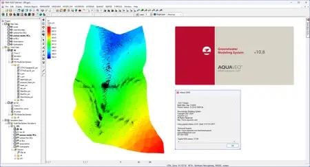
TheGroundwater Modeling System (GMS)is a comprehensive graphical user environment for performing groundwater simulations. The entire GMS system consists of a graphical user interface (the GMS program) and a number of analysis codes (MODFLOW, MT3DMS, etc.). GMS was designed as a comprehensive modeling environment. Several types of models are supported and facilities are provided to share information between different models and data types. Tools are provided for site characterization, model conceptualization, mesh and grid generation, geostatistics, and post-processing.
GMS
Instructional videos for the Groundwater Modeling System (GMS) program developed by Aquaveo.
Aquaveois a pioneer of GIS-based software solutions for hydraulic, hydrologic and groundwater modeling. Our products have been refined over two decades to create the most advanced environmental modeling and visualization software available. In addition to interfacing with industry standard numerical models, we develop custom desktop and cloud-based applications tailored to specific needs. Aquaveo began as a part of the Engineering Computer Graphics Laboratory at Brigham Young University in 1985. The lab was reorganized and the name was changed in September, 1998 to the Environmental Modeling Research Laboratory (EMRL). In April, 2007, the main software development team at EMRL entered private enterprise as Aquaveo, LLC.

Aquaveo Groundwater Modeling System (GMS) 10.8.8 Torrent Download , Aquaveo Groundwater Modeling System (GMS) 10.8.8 Crack Download , Aquaveo Groundwater Modeling System (GMS) 10.8.8 Patch Download , Aquaveo Groundwater Modeling System (GMS) 10.8.8 Serial Keygen Download
