MP4 | Video: h264, 1280x720 | Audio: AAC, 44.1 KHz, 2 Ch
Genre: eLearning | Language: English + .srt | Duration: 9 lectures (2h 8m) | Size: 1.17 GB
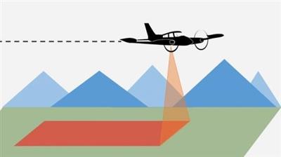
photogrammetry
What you'll learn:
Full photogrammetric operations automation with comprehensive quality control at all stages of data processing
TREATMENTS OF SATELLITE IMAGES BY PHOTOMOD
Full line of data output: DTMs, 3D vectors, orthoimages, digital maps
Requirements
THE NOTIONS OF PHOTOGRAMMETRY
General principles and main stages of the photogrammetric production line
topographic mapping, cadastral mapping, architecture and construction
Description
PHOTOMOD is to provide the world-wide geospatial community with advanced and cost-effective digital photogrammetry solutions and services for creation of wide range of output products from the available remote sensing data.
Scope of activity
-Development of digital photogrammetric system PHOTOMOD and its promotion on the worldwide market
-Promotion of supplementary geoinformatics software products
-Satellite imagery distribution
-Photogrammetric production service.
Main PHOTOMOD advantages
- Complete image data processing workflow without third party products
- Wide range of supported sensors
- Full line of data output: DTMs, 3D vectors, orthoimages, digital maps
- Multiple data exchange formats
- Full photogrammetric operations automation with comprehensive quality control at all stages of data processing
- Flexible modular architecture
- High scalability to terabyte-sized mosaics
- Distributed network configurations for large projects implementation
- Wide choice of stereoviewing options: LCD glasses or screens, simple anaglyph glasses .
Main PHOTOMOD functions
-Aerial triangulation and block adjustment
-Processing of aerial and satellite images
-Flexible strategy for DTM generation and editing
-Contour lines building, editing and smoothing
-3D feature extraction
-Orthomosaicking
-Digital maps creation and output
The course
PHOTOMOD UAS Montage Desktop
- Creating backup copies of projects
- Project packing
PHOTOMOD UAS Raster Converter. Preparing images
- Data formats
- Images conversion options
- Radiometric correction
PHOTOMOD UAS Montage Desktop. "W/O project" mode
- Project coordinate system
- Loading georeferenced data
- Converting vector objects and images from one coordinate system to another
PHOTOMOD UAS Montage Desktop. Creating a project of the type "Central projection":
- Digital camera
- Specifying the project name
- Selection of the coordinate system
- Adding images to a resource project
PHOTOMOD UAS Montage Desktop. Main Toolbar
- Main window. Options
- Toolbars
PHOTOMOD GeoCalculator
- Coordinate systems and cartographic projections
- Tools for creating user-defined coordinate systems
PHOTOMOD UAS AT. Interior and relative orientation
- Import of exterior and interior orientation elements from metadata of digital cameras
- Interior orientation of images obtained from a digital camera passport
- Import of onboard elements of exterior orientation
- Direct georeferencing
- Automatic block splitting on strips
- Block adjustment using onboard elements of exterior orientation
- Manual measurement and editing of tie points
- Methods for automatic measurement of tie points
- Report on relative orientation. Visual control of results
- Measurement of control points
PHOTOMOD UAS Solver A. Network alignment
- Batch mode with aerotriangulation
- Methods for calculating the initial approximation
- Block adjustment methods
- Systematic errors compensation
- Network alignment using camera self-calibration tools
- Block adjustment report
PHOTOMOD UAS Montage Desktop. Stereo window
- Stereo modes
- Hotkeys
- Tools for controlling parallax
- Tools for managing the marker
- Creating and editing vector objects
PHOTOMOD UAS DTM. Creating a digital terrain model
- Variants of manual DEM creation
- Variants of automatic DEM creation
- Creation of digital terrain models:
- Pickets and structural lines
- TIN
- DEM
- Filtering of objects above the ground
- Editing of pickets and structural lines
- Construction of TIN and DEM in batch mode
- Working with contours
- Monitoring of the accuracy of DEM
- Calculation of volumes
- Import / Export
PHOTOMOD UAS dDSM. Dense DSM creation with SGM method
- Building dDSM
- Filtering dDSM:
- Buildings and vegetation filter;
- Slope-based filter
- Filling null cells
- Building 3d-point cloud in LAS format:
- LAS viewer
- Filtering 3d-points (LAS)
- Building True Ortho:
- Filling null cells
- Color balancing
PHOTOMOD UAS StereoDraw. Stereovectorization.
- Functional features of the module of creating and editing 3D objects.
- Using the classifier
- Operations with vector data
- Editing objects / vertices
- Group editing
- Working with layers
- Mode of automatic following on a relief
- Snapping
- Topological operations and topology control
- Exchange with GIS and CAD systems through popular formats. Working with attributes
- Semi-automatic function of digitizing roofs
PHOTOMOD UAS 3D-Mod. 3D-modeling
- 3D feature extraction with classifier
- Vectorization rules
- 3D-Mod tools
- Texture covering
- Animation recording
- Export of 3D-models to DXF, COLLADA (.dae) and other 3D-vector formats
PHOTOMOD Mosaic / GeoMosaic. Creating orthophotos
Mosaic project:
- Usage of various types of DEM for orthorectification
- Usage structural lines for orthorectification
- Select output raster formats
- Orthomosaic accuracy control
GeoMosaic Project:
- Loading of orthorectified images into the project
- Options for cutlines
- Automatic brightness adjustment tools
- Split into sheets
- Mosaic preview and building
Who this course is for
TOPOGRAPHERS
ENGINEERING GEODESIE
PHOTOGRAMMETRY
Homepage
https://www.udemy.com/course/photomod-professional-course/
Buy Premium From My Links To Get Resumable Support,Max Speed & Support Me

https://uploadgig.com/file/download/4aDa1d4d29059424/198kd.The.complete.photomod.professional.course.part1.rar
https://uploadgig.com/file/download/9A80e1316150ad99/198kd.The.complete.photomod.professional.course.part2.rar

https://rapidgator.net/file/34bdd906a04e18705920168bc17ef87f/198kd.The.complete.photomod.professional.course.part1.rar.html
https://rapidgator.net/file/a49165e4905f9b8f09839263c6e59dba/198kd.The.complete.photomod.professional.course.part2.rar.html

http://nitroflare.com/view/AF445907FA40D0C/198kd.The.complete.photomod.professional.course.part1.rar
http://nitroflare.com/view/E274A35D5EAA209/198kd.The.complete.photomod.professional.course.part2.rar
Download now LINK
